AQAssure
A Python project that forecasts PM2.5 levels using satellite imagery and local weather conditions.
| Year | 2025 |
| Website | GitHub |
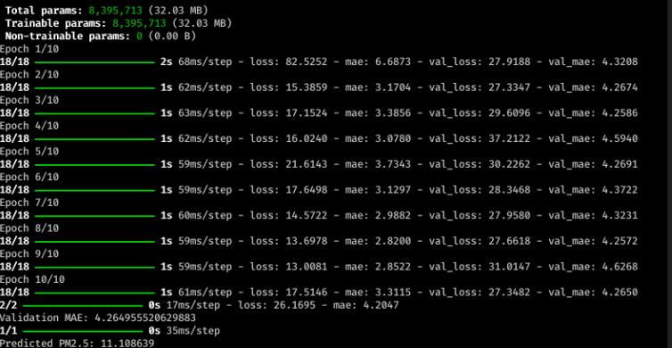
AQAssure gathers data from the OpenAQ and OpenWeather APIs, aligns the measurements, and trains a convolutional neural network. The model processes satellite images with convolutional layers while numerical weather features go through fully connected layers. The combined output predicts particulate matter levels so users can plan their outdoor activities with confidence.
Challenge
Making reliable air quality predictions with limited satellite imagery and heterogeneous data sources.
Action
Data pipeline
Fetched pollution and weather information, preprocessed and synchronized the datasets, then trained a CNN using PyTorch.
Result
The prototype forecasts PM2.5 values and lays the groundwork for incorporating real satellite imagery and more advanced architectures.